exploring
Behind the Organ
Last weekend’s adventure involved a Sunday-afternoon field trip to learn how they make pipe organs. There’s an organ builder in town (well, just outside town), and every so often when they’ve got an organ built and ready to ship, they have an open house to show off their workshop. One of the founders of the company (now retired) is in our choir, as is one of the current owners, along with several employees. The woman who makes the metal pipes often sits next to me in choir, and our assistant organist works there. This company built our church’s current organ, so if something goes wrong with it, we’ve got a lot of people in the choir loft who would know how to fix it.
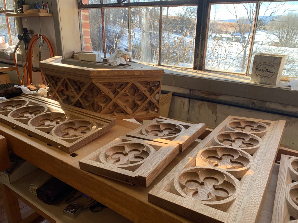
The workshop is in an old school building just outside town, and it looks like they hollowed it out so that the main room goes all the way to the roof. They need all that space to put the organ together, and even then they don’t have enough room to put the biggest pipes in the proper configuration. They put the organ together as close to the way it will be in its final home to connect all the pipes and rig it all together, do a preliminary tuning and voicing and test it, and then they disassemble the whole thing and transport it to its home, where they assemble it and then do a final voicing and tuning, since the location affects the sound. This company makes mechanical organs, so there are no electronics. They only need electricity to power the fan and bellows. Otherwise, these organs are just like those built hundreds of years ago.
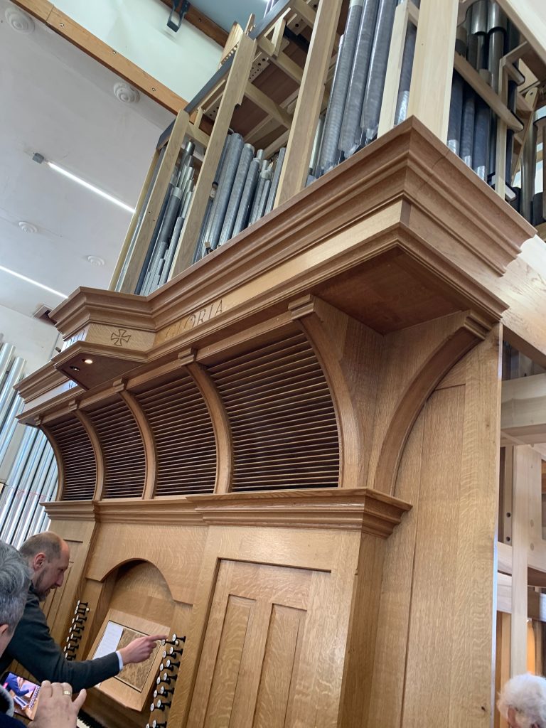
It was really neat seeing what’s inside the organ from the back, since it’s not in the kind of cabinet it will be in when it’s finally set up. I’ve seen bits and pieces of the inside of our organ, but not the parts that are usually hidden.
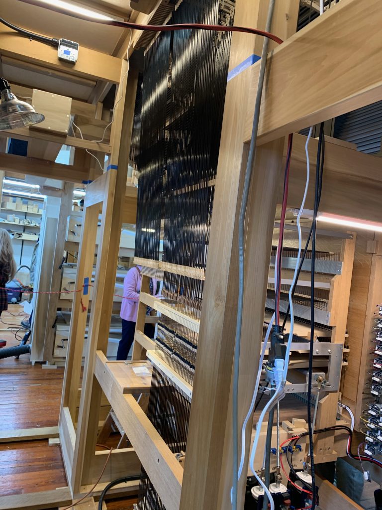
This company has its own lumber mill nearby (we saw the outside of this because the person who was driving initially followed the wrong GPS directions, having it take us to the mill instead of the workshop), and most of the wood is hand-carved, though they do use some computer-assisted cutting where precision is important. The woman who makes the pipes does it all by hand, and there are about 3,000 pipes in an organ. She says she goes through a lot of audiobooks while working.
A retired church organist was there playing the organ, so there was a nice soundtrack for exploring the workshop and socializing. Not only did I run into a lot of people from church, but I also saw one of my neighbors there.
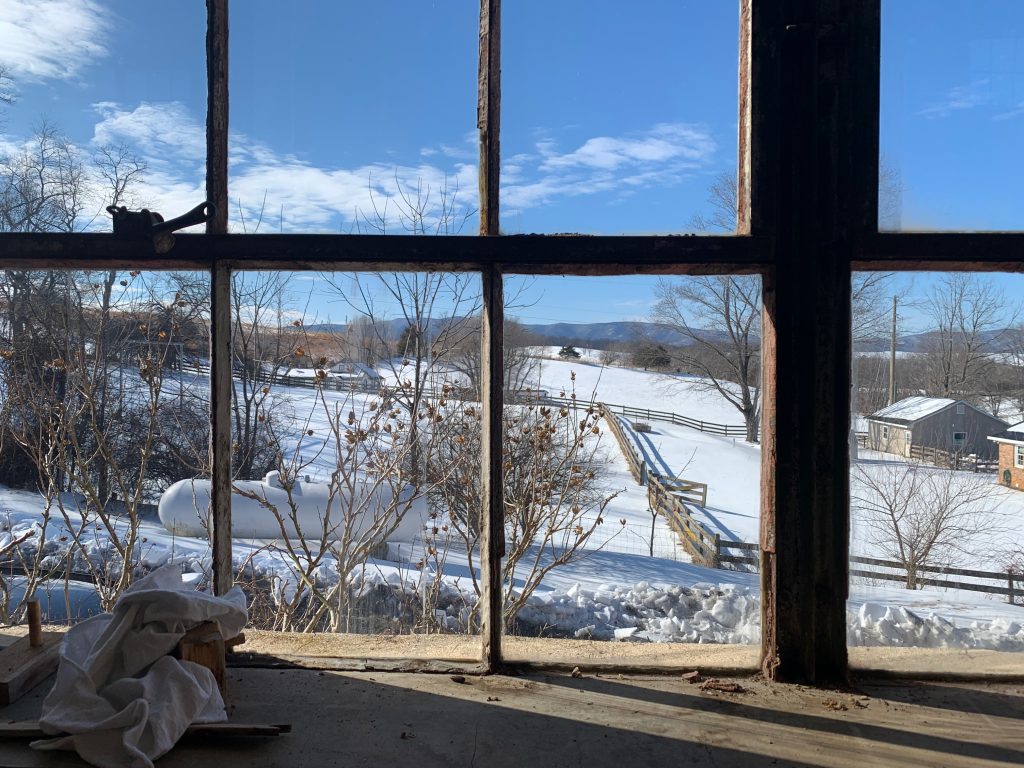
And we also got some nice scenery. One of the few good things about the crust of ice on top of the snow was that it keeps it all looking pristine, so we saw rolling snow-covered hills with mountains in the background.