Life, exploring
Over the Mountain
Last Friday’s adventure involved a lot of driving in the mountains. I need to get a topographical map because the road map doesn’t tell the full story or adequately prepare me for the road I’ll be driving on. I think the map might even straighten the roads a bit instead of showing every twist and turn. I’ve learned that if an otherwise straight road on the map has a section that suddenly shows a lot of zigzags, that’s a sign that the road is going through mountains, and those zigzags are switchbacks and hairpin turns. I’ve been reading about going through mountain passes all my life but it turns out my impression of what that meant has been inaccurate. I’ve pictured a cleft between mountains, a simple up and over in a relatively low spot. But that turns out to be an inaccurate impression because that relatively low spot is still up pretty high, so you have to climb to get to it, and that often means going along the side of a mountain with a lot of switchbacks.
So, I set out heading west on what amounts to the major east-west road around here. I don’t know how old this road is, but there’s a coaching inn on it that dates to 1812. That’s before you get to the mountains, but there’s nothing much past it until you get through the mountains, and the town past the mountains was pretty old, so I think the road through the mountains may be that old. It was definitely built before they did things like dynamite mountains to put roads through. It was actually kind of a fun drive, if sometimes a bit harrowing. I was very glad I was driving my Subaru, which has all-wheel drive and is built for that sort of thing. While twists and turns were kind of fun with the stick shift in my old car, this might have been a bit much for that car to handle.
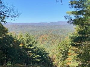
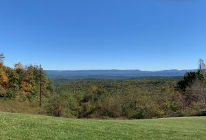
At the top of a mountain, there was a scenic overlook at a Civil War battlefield, where the Confederate army dug in to defend the pass (which suggests the road through the mountains may date back at least that far). They’ve preserved one of the trenches, but you can also see where there are terraces dug into the side of the mountain. There’s a short hiking trail with signs along the way containing excerpts from letters sent by a soldier who was there, talking about his experiences. On a sunny autumn day, it was chilly up there, so I can’t imagine spending part of a winter there (they got snow around there early this morning). It did make for a glorious vantage point for viewing the valley and more mountains beyond it. The mountains here are in waves of ranges with valleys of varying size in between, so it’s a bit of harrowing mountain driving, then flat valley, then more mountains, then flat driving, etc.

After a couple more harrowing mountain passes, I reached a valley with a little town that’s close to the West Virginia border (if I’d known how close it was, I might have driven on a bit just to add another state to my list). They were having their fall festival. I walked around a bit and got some tourist information. This area is a big producer of maple syrup, and they have a syrup festival in the early spring that I’ll have to go to. In this area, the trees were all red and gold, and it was beautiful, but I didn’t manage to get a good photo because the angle of the sun was wrong.
Elements of the festival were scattered around the area, and I headed off the main road to get to where they were supposed to be doing more stuff, but that road turned out to be a tiny byway that really twisted around the mountains. The place I was heading seemed to appear out of nowhere around a bend, right at a time when I had two trucks behind me, so I couldn’t stop abruptly or turn back. It’s a place that’s part of the syrup festival, so now I know what to look for when I go back. I ended up making a loop and going what the locals call “over the mountain” at a different pass, one my friend calls “the one that’s not scary,” and now I know what she means. It’s a bit more straightforward up and over drive.

In all, I saw some beautiful fall color and found several places I’ve read about that now I know how to get back to for more in-depth exploration. A lot of the driving was through forests, in places where the trees arch over the road and form a tunnel. That’s one of my favorite things, to drive or walk through a tunnel of trees. I opened my sunroof so I could see the trees over my head.
This weekend’s adventure is going to involve an open house day at the Mennonite Heritage Farm. I hope to learn some stuff I can use in my books. I may also visit an apple orchard that’s nearby as I continue my quest for apple cider donuts.
